Asheville weather

828 Weather Direct

Bringing the latest local conditions into focus

828 Weather Direct
Hyper-local Asheville forecast built by Tim Ballisty
Updating obs
Asheville --°
Dew point --°
Humidity --
Wind -- mph
Pressure --"
Rain chance --
Clouds --
Now in Asheville
--°
Reading the sky
Reading the current comfort signal.
Temperature, humidity, dew point, wind, and sky cover are loading before the full read appears.
--° Feels like
--° Dew point
-- mph Wind
-- Rain chance
Current Sky

Reading the Asheville sky.

The camera snapshot adds visual context to the FeelScore and next-few-hours forecast.

Comfort stays first, then the page adds what the sky actually looks like right now.

Loading Camera capture --
-- Camera cloud cover
-- Sunlight signal
-- Sky read confidence
Now Visual weather layer
Sunset Radiance

Evening color becomes worth a closer look.

After 3 PM, the homepage can elevate Sunset Radiance when clouds, sunlight, and timing give the evening sky a real chance to perform.

WatchLive
Near-term comfort outlook

FeelScore next few hours

86
11 AM
70°FeelScore 86
12 PM
72°FeelScore 84
1 PM
73°FeelScore 82
2 PM🌧
74°FeelScore 76
3 PM
75°FeelScore 78
4 PM
75°FeelScore 80

The Next 6 remains the practical timing strip. The Current Sky card above gives it a visual proof point: overcast, bright, dim, clearing, foggy, or stormy.

Live Weather Note

What I'm watching in the weather right now.

The Pulse module can reference the same sky signal when it matters: “The camera view backs up the forecast: clouds are in control, but there is enough filtered light to keep things from feeling gloomy.” This keeps Pulse editorial, while the sky card stays observational.

Pulse image
Latest 828 Weather Update thumbnail Latest Substack
828 Weather Update

The Story of Asheville's Wild Spring

Drought concerns, early-season heat, record rainfall, and a fluctuating local climate. That was spring 2026 in Asheville.

Published June 4, 2026
Drought & Fire Threat

High fire risk needs a closer read.

92 Drought stress 65 Fire threat

Very dry fuels are the main driver, even when wind and humidity are not extreme.

Fuel dryness Severe Soils and fuels are running very dry.
Humidity -- Humidity can limit spread when it stays elevated.
Wind -- Wind decides whether dry fuels become an active spread concern.
90-day rainfall -- Rainfall deficit is updating.
Since Sep. 1 -- Seasonal deficit is updating.
Soil moisture -- Soil stress is updating.
Trend -- Next few hours are updating.
How to read this: these are local guidance indices. They are not official warnings, but they help show whether the landscape is drying out and whether today's weather could make fire easier to start or spread.

Drought Stress

The background dryness signal. It leans on rainfall deficits, soil moisture, vegetation stress, and how slowly fuels may recover without meaningful rain.

Fire Threat

The today signal. It blends dry fuels with humidity, wind, temperature, and whether conditions favor ignition or spread during the day.

Drought Stress scale

0-39Dryness is limited or just beginning.
40-59Moderate stress: rainfall deficits matter.
60-79Severe stress: soils and fuels are meaningfully dry.
80-100Extreme stress: recovery likely needs soaking rain.

Fire Threat scale

0-39Moisture or calm weather limits spread potential.
40-59Elevated: dry fuels, low humidity, or wind deserve attention.
60-79High: ignition and spread become more concerning.
80-100Extreme: very dry fuels and fire weather may align.
  • Drought Stress changes more slowly because it tracks accumulated dryness.
  • Fire Threat can rise quickly on breezy, dry afternoons.
  • High drought plus high fire threat means the landscape is primed and the day may activate that risk.
  • Rain can lower fire threat quickly, but drought stress usually needs repeated or soaking rainfall.
New Asheville traffic desk

I-26 Connector Center

Live NCDOT closures, corridor cameras, construction milestones, project updates, and weather impacts in one place.
Open Connector Center
Hiking Guidance

Pick the trail by the mountain mood.

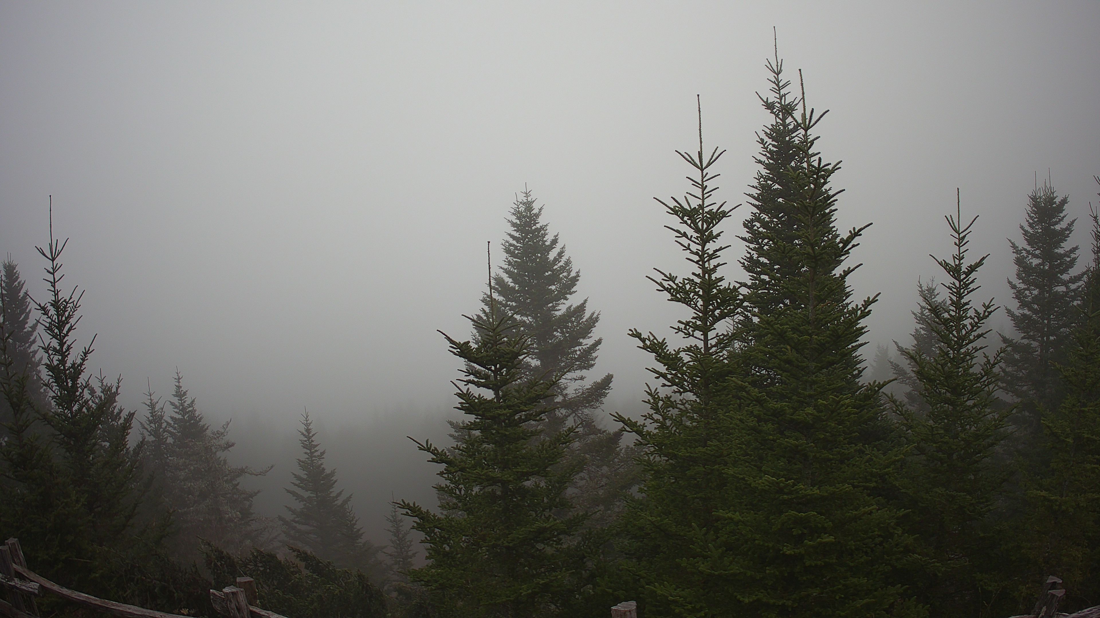
Live Mount Mitchell summit camera preview
Mountain views now Mitchell summit cam plus Pisgah Inn at 5,000 ft help check cloud deck and visibility.
82 HikerScore 15° Mitchell drop

Lower and mid-elevation trails look manageable, while Mount Mitchell and exposed ridges still deserve a separate wind, cloud, and layer check.

Best bet Lower to mid-elevation trails where cloud cover helps comfort.
Use care Higher peaks can feel cooler and more exposed than Asheville.
Water Conditions

Check waterfalls and river plans before you go.

9 waterfalls 8 river segments

A local read on waterfall flow, tubing, paddling, fishing, and swimming around Asheville and WNC.

Waterfalls Recent rain, basin response, photo potential, and slick-rock caution.
Rivers Activity-specific guidance for tubing, paddling, fishing, and wading.